Regenerating Los Angeles
through the lens of water

History
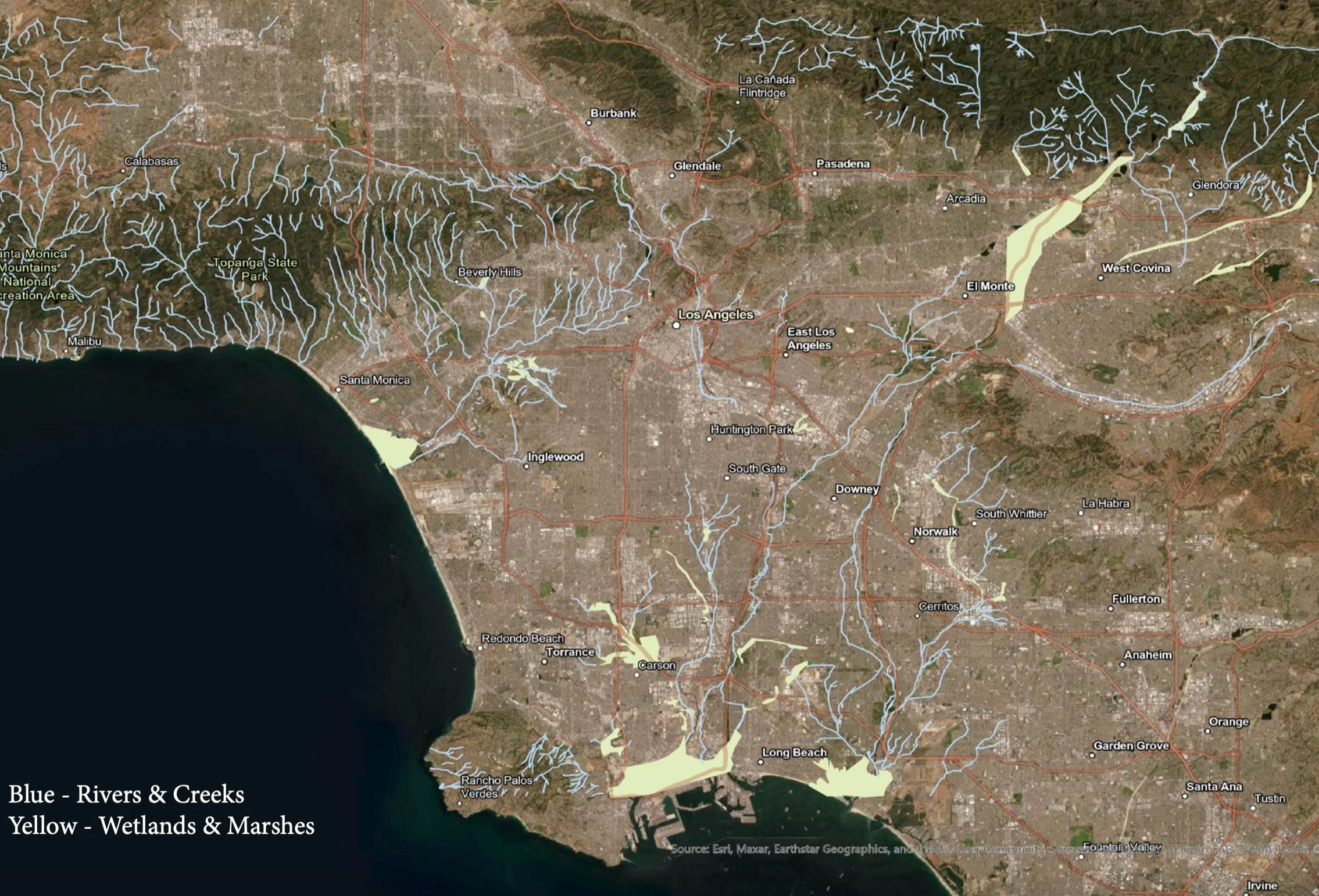
The first settlement of the region known as Los Angeles occurred more than 8000 years ago, where the Tongva-Gabrieliño trace their origins. For millennia, the Tongva lived a semi-nomadic lifestyle in villages of about 100-150 people which were designed in reciprocity with the various beings and features of the land. The Los Angeles basin is a floodplain, and throughout most of its ecological history, the Los Angeles River, San Gabriel River and thousands of smaller creeks were allowed to meander freely across the landscape. Wetland marshes, riparian forests and tributaries would normally absorb excess water to recharge local aquifers, reducing the severity of both floods and droughts. Though the region naturally experienced periods of drought, the Tongva developed an extensive network of TEK which allowed them to flourish within this dynamic climate and facilitate the reproduction of the entire socioecological system.
This largely changed in 1769, when Spanish settlers constructed the first missionaries. Though this story is marked by enslavement, erasure and profound loss, it is also characterized by the immense resilience of the Tongva people to this day.
As the missionaries expanded, the Spanish brought European systems of ranching and intensive monoculture to the Los Angeles region. Being a floodplain, the land was not suited for this type of cultivation. This became economically obvious in 1862, when three major rivers merged and completely inundated the vast majority of the land, resulting in widespread crop failure and the loss of thousands of cattle. After this, immigrants and city planners relinquished agricultural produciton to central Califronia, and Los Angeles turned toward urbanization.
History (continued)
The mid-to late-1800s was a period of rapid growth and development for Los Angeles. As urbanization intensified in the early 20th century, the demand for new buildings and roads caused the natural floodplains and tributary systems to be replaced with asphalt and concrete. Because these materials prevent water absorption into the soil, they compromise groundwater infiltration and make the city even more vulnerable to violent flooding.
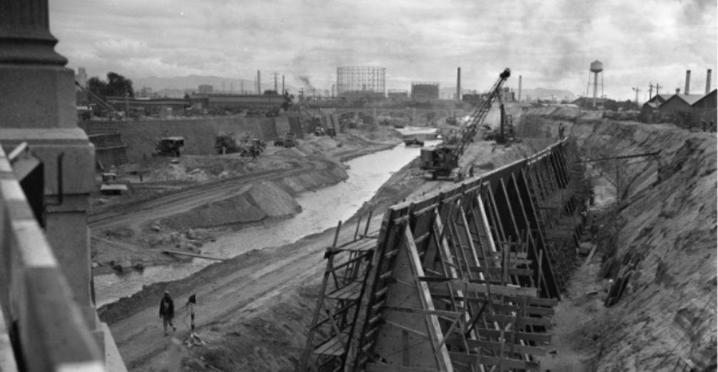
This culiminated in March of 1938, where L.A. experienced its most disastrous flood yet. After receiving a year’s worth of rainfall in a few days, the Los Angeles River overflowed. Because nearly all of the hydric soils had been buried, vegetation cleared and rivers paved over, there was nothing to slow down or absorb the water. This resulted in the deaths of over one hundred people and the destruction of over 5,600 buildings.
As a response, the US Army Corps of Engineers channelized the LA River with concrete—so that stormwater would more rapidly flow into the ocean—and created an extensive network of dams in the Santa Monica and San Gabriel Mountains. While these measures saved lives in the short-term, the lack of groundwater recharge has led to chronic drought conditions in LA today.
Today, the city faces a host of interconnected problems: flooding, drought, extreme temperatures, and wildfires. While these issues may seem separate, they are all symptomatic of our underlying relationship to water.
What’s more: 70% of LA’s fresh water is discharged into the Pacific Ocean.
Methodology
Mine USGS for historical geo-referenced topographic maps
Manually retrace rivers, wetlands, and water features
Overlay on contemporary maps via ArcGIS
Compare to Modern Flood Risk
Design Installation of Local Hydrological Recycling Plants
Historic Watershed
Contemporary Flood Risk
Past efforts at controlling flood risk emerged from the logic of domination. How might an alternative ethic rooted in reciprocity manifest at the urban scale? Can we reintegrate Los Angeles into its surrounding ecologies?
Mood Board: Year 2100
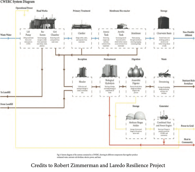
Community Water and Energy Resource Center (CWERC): Solving Scarcity and Abundance
Key Idea: Locally treat stormwater and wastewater to regenerate historic rivers for flood control and drought management.
Multi-step process: Lift Pump —> Bar Screens/Grit Chambers —> Clarifier Pools —> Membrane Bioreactors (Aerobic and Anaerobic Steps to remove phosphates and nitrates)* —> Porous Clay Membrane —> Potable Water —> River Recharge
*Solid Waste pyrolyzed to power the system autonomously.
Siting
CWERC Capacity: 5 million gallons/day; Los Angeles Utilization: 510 million gallons/day.
CWERCS Needed: ~102 distributed according to demand, topography and cost of transport.
Paired with concrete removal and re-planting of native and beneficial non-native species for riverbank stabilization, flood control and cultural value.
Key ecosystems: riparian forest, coastal sage scrub, and wet meadow.
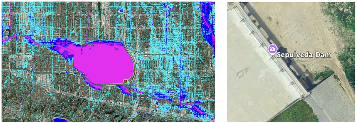
Close to Home: Sepulveda Wildlife Basin, Encino
In the Northwest region towards the head of the LA River, there is a major flood zone which coincides with a golf course and wildlife preserve. Currently, there is a dam installed to prevent catastrophic damage to densely packed suburban housing units.
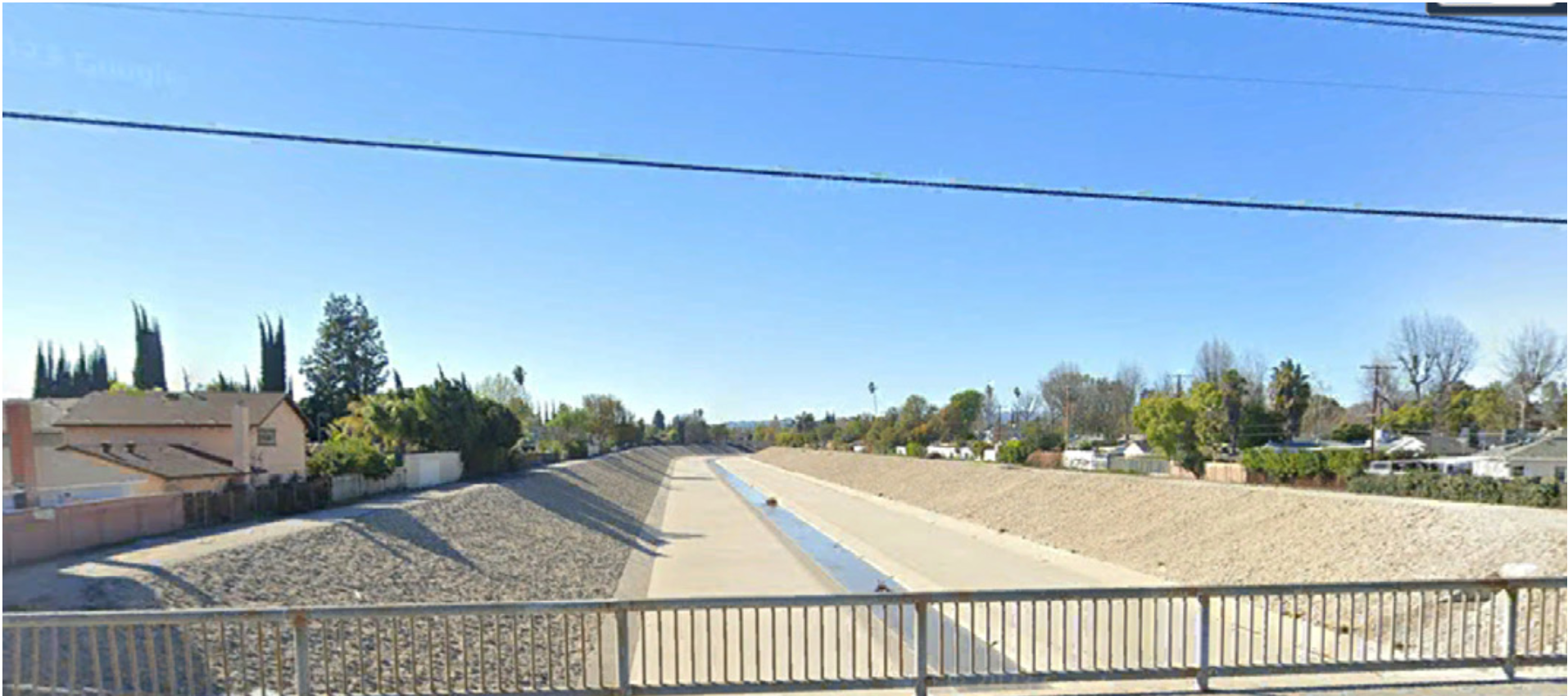
To mitigate flood risk, I looked upstream to analyze the land-use cover and management of the river. As expected, it is purely lined with concrete (bottom left). In the bottom right image, I modeled what an upstream intervention could look like to prevent flooding for the local community while improving the natural beauty of the neighborhood.
2024:
2027:
By continuing down the LA River and working with the LA River Revitilization Committee, perhaps we can revive the historic habitation in the heart of the city by 2030.


